waterfalls

Portland Interlude

Cathedral Park

In mid-September, my wife and I took a trip out to Portland, Oregon for a week, for a vacation. Besides getting the wonderful opportunity to spend some time with family up there, we took the opportunity to do a little hiking around the Portland area. The three hikes we took during that week are the Lower Maple Trail Loop in Forest Park, the Oak Island Trail on Sauvie Island, and Horsetail Falls along the Columbia River Gorge.

View of the mountains outside of Portland
Moss covered trees
Trail running through trees
Maple leaves backlit by the sun
A stump and twisted branches covered by moss
Stand of trees in Sauvie Island
Small lake
Grassy trail
Wild blackberries
Closed Queen Anne's Lace
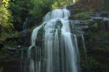
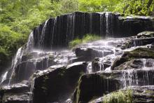
Waterfall flowing between rocks
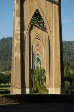
Underside of bridge

Hidden Away

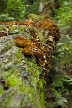
Shelf mushrooms on a fallen log

In early September, I took this trip to view Hidden Falls, in Oconee State Park in upstate SC. The trail starts from the Foothills trailhead. Round trip, this hike is about 5.5 miles, but it's a relatively easy hike. It's only as one approaches the falls that the elevation changes significantly. Approaching the falls, the trail dips downward into a small valley, and of course, that means one has to climb back up later. 

Top of a round white mushroom
Two spiky-headed mushrooms, one large, one small
A orange-colored maple leaf surrounded by green ones
Gnarled tree trunk
Shiny red shelf fungi
Trail heading off into green foliage
Trail heading off into the forest
Small orange and yellow mushroom with an inverted cup
White coral-like fungus
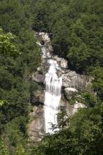
Waterfall
Shelf mushrooms along a fallen log
Small water cascade
Small violet flower with red berries

A Leap of Faith and a Beautiful Waterfall

Long Creek Falls

I had tried to find the Long Creek Falls trail some weeks before, and failed. I ended up on the Oconee Trail, instead. But, I decided to try again to locate this trail. The directions say to take Hwy. 76 up towards Clayton from Westminster, SC. You turn left at Damascus Church Road and then turn right on Battle Creek Road. So far so good. This is where it gets difficult. According to the directions I'd found on the web and in my waterfall hikes manual, the next step is to turn right on Turkey Ridge Road, also known as FS755.

Photos of trees
Photo of dirt road through trees
Photo of cluster of flowers
Photo of waterfall
Photo of Chattooga River
Photo of butterfly
Photo of waterfall
Photo of waterfall
Photo of smaller cascade
Photo of hill
Photo of yellow flower

Falls and Fungi

The Lower Whitewater Falls Trail starts just short of the North Carolina - South Carolina border on Hwy. 130 from a parking lot of Duke Power's Bad Creek Hydroelectric Station. This 2-mile hike in to an overlook for the falls is moderately strenuous, and provides a series of great views through extremely varied terrain.

photo of trail
photo of rhododendron forest
photo of small fungi
photo of mushroom with water in upturned cup
photo of fern frond
photo of bridge
photo of yellow fungus
photo of waterfall
photo of waterfall
photo of mushrooms
photo of white blooms
photo of waterfall

The Stunning Yellow Branch Falls

photo of waterfall

About 20 miles north of Walhalla, SC is the Yellow Branch Recreation Area, which contains the trailhead for the Yellow Branch Falls trail. This trail winds its way across streams may times before reaching the Yellow Branch waterfall. This trail is about 1.5 miles to the falls, and it is an easy-to-moderate hike.

photo of trees
photo of toad
photo of waterfall
photo of waterfall
photo of waterfall
photo of waterfall
photo of waterfall
photo of waterfall
photo of rock growing around boulder
photo of amphibian
photo of fungi
photo of insect
photo of rhododendron bloom
photo of fallen tree roots

Lake Jocassee's Raven Rock Trail

Photo of treetops

The Raven Rock trail is part of a small network of hiking trails in the Keowee Toxaway State Park in upstate South Carolina. This trail is a loop trail that branches off from the Natural Bridge loop trail, in the same area. Together, the Natural Bridge and Raven Rock trails form a 4.1-mile loop. The trailhead for these two trails is just off the visitor's center for the park, just off of Hwy. 11, between Hwy. 130 and U.S. 178.

Photo of natural bridge
Photo of tree and rock
Photo of rock vista
Photo of moss-covered rock
Photo of lizard on tree
Photo of root-strewn trail
Photo of Jocassee lake
Photo of lakeside
Photo of trees
Photo of treetops
Photo of tree roots
Photo of waterfall

Pages

Subscribe to RSS - waterfalls