Winter is Coming to Paris Mountain
Sunday, December 30
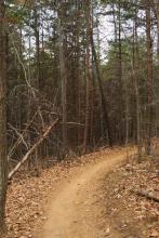
In mid-December, I took the Sulfur Springs trail, a 4-mile hike that is part of the Paris Mountain State Park network of trails. I had tried to take this hike a week earlier, but got too late a start and had to return too soon. This time, I made it the whole way through.