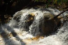
Caesar's Head
Looping through Caesar's Head
Back to the Mountain Bridge Wilderness Area in upstate SC, this time for the Coldspring Branch Trail. Originally, I had intended to take the Coldspring Branch Trail, a 2.6-mile trail and then come back along the Bill KImball trail. When I conferred with the ranger at the Caesar's Head Visitor's Center, however, she advised that I come back along the Jones Gap Trail, which would be another 2.5 miles or so, to complete the loop.
Strange Weather Patterns
So, in mid-January, I headed over to Caesar's Head State Park, to do some more hiking in the Mountain Bridge Wilderness Area, north of Greenville, SC. This is the same area as the Frank Coggins Trail, which I have done a few times. On this occasion, I decided upon the Raven Cliff Falls Trail, a moderate 2.2-mile trail.
Twilight Hike
One weekend towards the end of fall, I was rushing to get my hiking fix, and almost didn't make it before the sun went down. I returned to a favorite hike in Caesar's Head State Park, the Frank Coggins Trail. This trail is part of the Mountain Bridge Wilderness Area, situated near the end of the Cherokee Foothills Scenic Highway, Highway 11, north of Greenville. The trail is a moderate, hour-long trail, and it is a beginning to many of the other trails in the area.
