South Carolina

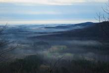
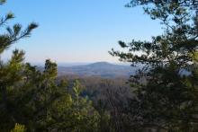
Overlooking the Countryside

countryside

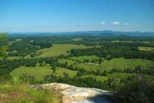
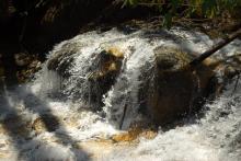
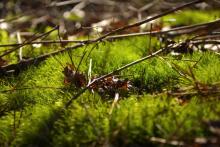
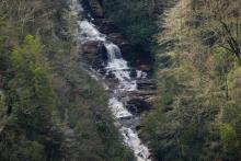
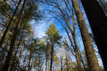
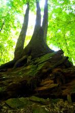
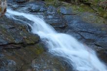
It has been much harder than I might have expected to go hiking during the summer. My weekends have been filled up with other activities and distractions, but I started jonesing for the outdoors, so I made some time for a quick trip into the mountains. Due to time constraints, I decided to go to a place I've been before, Glassy Mountain, a short hike just north of Pickens, SC.
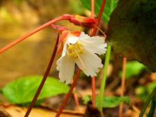
rural countryside
rural countryside
rock overlook
daisies
blue flower
red trumpetlike flower
closeup of red trumpetlike flower
green nuts on tree
closeup of red trumpetlike flower

Sometimes it Pays to Bring a Map

sunlight through trees

In late May, I took what turned out to be a 7 or 8 mile hike in upstate South Carolina, just north of Walhalla. The Blue Ridge Railroad Historical Trail is a 2.5-mile in-and-out trail that begins at Stumphouse Tunnel Park and follows an incomplete railbed for the Blue Ridge Railroad. This railroad was begun in 1852, with the intent of connecting Knoxville, TN with Charleston, SC. The railroad itself was to involve a line to be built from Anderson, SC to Knoxville, through 13 tunnels that were to be dug as part of the project.

waterfall
waterfall
waterfall
flowers
tunnel
flowers
trees
flowers

Brief Adventure

waterfall

The day after I hiked up to Rainbow Falls, I decided to take another quick trip in the morning, to Blue Hole Falls. This is a short, half-mile hike to the waterfall, which flows out between cliffs into a pool of water. It is this pool of water that gives the falls its name. I figured a swift in-and-out hike, but it ended up a bit longer than expected.

leaves
snail
cascade
falls
waterfall
waterfall
cliffside

To the Tolling of the Bells

This week I had taken a few days off, and my in-laws had gotten into town the weekend before. On the last day of their visit, they joined me for a short hike in Devil's Fork State Park in upstate South Carolina. The trail we took is the Oconee Bells Trail, which is a 1-mile loop through the park. The trail is named for the Oconee Bell, one of the rarest wildflowers in the United States.

opening under fallen tree
rocks along creek bank
waterfall
Oconee Bell wildflower
tree knot
Oconee Bell wildflower
moss

Looping through Caesar's Head

waterfall

Back to the Mountain Bridge Wilderness Area in upstate SC, this time for the Coldspring Branch Trail. Originally, I had intended to take the Coldspring Branch Trail, a 2.6-mile trail and then come back along the Bill KImball trail. When I conferred with the ranger at the Caesar's Head Visitor's Center, however, she advised that I come back along the Jones Gap Trail, which would be another 2.5 miles or so, to complete the loop.

roots
old stump
knotted tree roots
rotted tree stump
small waterfall
small greenery
mushrooms
trees and rocks
rushing rapids
waterfall

Mud and Horses

moss

I was looking for a quick hike on the first Sunday afternoon in March, and so I found the Fant's Grove Wilderness Management Area. I decided to take the Johnstone/Fox trail, a 2.5 mile multi-use trail. It turns out to be between Clemson, SC and Anderson, SC, closer to Clemson. After a few wrong turns, I found the trailhead and set off to see how this trail would go.

dead tree
needle strewn trail
wooded glade
Mossy tree trunk
sky through the trees
trail
moss
agricultural field

Icy Morning Hike

clouds in the mountains

On the last weekend in January, I headed out to Oconee State Park to try out the Tamassee Knob trail, a moderate 2.1-mile hike (one-way) to the top of a 1,620-foot peak in upstate South Carolina. A beautiful hike, made a little more interesting by lingering ice from the previous cold night and some fantastic low-lying clouds.

trail
trail
tree trunk with moss
icy moss
odd tree trunk
new tree growth
clouds in the mountains
mushrooms on tree trunk
mountain view

First Hike for 2013

blue sky through trees

To start off my hiking in 2013, I returned to the place I started this blog with, the Keowee-Toxaway State Natural Area. In my first blog post, I described my hike along the Raven Rock Trail. The trailheads for the Raven Rock Trail are off of the Natural Bridge Trail, a moderate trail that takes just under an hour to travel. The main feature of the Natural Bridge Trail is, as one would expect, a rock bridge that traverses one of the creeks that can be seen along the trail. Overall, the trail is pretty moderate, although there is a rather strenuous segment near the end to be aware of.

mushrooms on tree trunk
sapling between rocks
moss on boulder
small waterfall
small waterfall
tree roots on boulder
mushrooms covering a log
tree stump
moss covered tree trunks
blue sky through trees

Last Hike of 2012

mountain view

For my last hike of 2012, I took a relatively short hike just outside of Pickens, SC. The hike was the Glassy Mountain Hike, which is part of the Department of Natural Resources Heritage Trust program. Apparently, this trail had been closed for the fall of 2012, as it was cleaned up and new erosion controls were put down. 

boulder
mountain view
trail
rocky slope
pine cones
water on rock
mountain view
flower
pine branch

Pages

Subscribe to RSS - South Carolina