winter

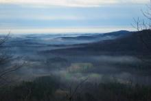
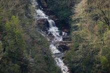
Winter at Norris Dam

striped bands of color around cracked stones

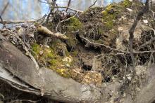
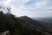
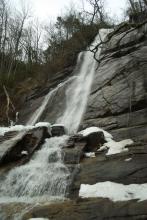
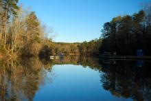
So, the last time I took this hike was during the summer. It's a nice little hike, and could even be longer, time permitting. It goes along the shore of Norris Lake, on the east side of the dam. It's composed of a bunch of small interlocking trails that allows the hiker to tailor their trip to the amount of time available. I didn't have the opportunity to spend a long time out there, so I just took a few trails and headed back.

roots of a fallen tree
tree growth
trees
roots of a fallen tree
trees
dam tower
lake view
cracked stones

Getting to the Point

old trunk

Back in early February, I decided to give the Loyston Point Recreation Area a try. There are a few trails on this peninsula that extends out into the Clinch River, most of which are multi-use (hiking and mountain biking). It was a chilly morning, but I headed off to hike the Loyston Loop Trail, a 5.4-mile trail that winds around a hill in the northwest part of the peninsula, passing by the river as it goes north, before looping back.

trail
trail
tree
tree trunk
mushrooms
trunk
trunk
old roots
old stump
river

It's Not Huskey, It's Just Big-Boned

trees shooting up from between boulder-strewn hillside

Some time ago, I was driving through the Smokies looking for a trail that I had found on the map called the Huskey Gap Trail. This trail was listed in trail guides as being 4.2 miles round trip and moderate. According to the official Smokey Mountains trail map, the trailhead was just off Newfound Gap Round, a few miles south of the Sugarlands Visitor Center.

trail beginning
rocky trail
trees growing out of boulders
boulders
spring
twisted branches
trees

Falls Creek Falls

waterfall

Not long after one of our southern snowfalls this winter, I set out upon the Falls Creek Falls trail, a challenging 1.5 mile hike up to an amazing waterfall. This hike is in the Mountain Bridge Wilderness Area of South Carolina. The recent snowfall was still in evidence on the waterfall itself, providing a unique view of the cascade.

small cascade
rocks
rocks
winter mountain view
waterfall
waterfall
waterfall
icy water
waterfall
trail
exposed tree roots

Visit to Stumphouse Tunnel

Stumphouse Tunnel

The Stumphouse Tunnel is part of the Blue Ridge Railroad, a project started in 1852 to connect Charleston and Knoxville. It was never finished due to lack of funds, but three of the tunnels still remain standing in various states of incompletion. I visited two of the others on the Blue Ridge Railroad Historical Trail, but did not visit the largest of these, Stumphouse. During the Christmas break, my wife and I went with her uncle to see the sights in the mountains, and Stumphouse Tunnel was one of the places we visited. I wouldn't classify this as a hike, but we at least viewed the tunnel itself, and Issaqueena Falls just nearby.

small waterfall
Stumphouse Tunnel
tree roots
Issaqueena Falls
trees as the sun goes down
curled tree root

Mud and Horses

moss

I was looking for a quick hike on the first Sunday afternoon in March, and so I found the Fant's Grove Wilderness Management Area. I decided to take the Johnstone/Fox trail, a 2.5 mile multi-use trail. It turns out to be between Clemson, SC and Anderson, SC, closer to Clemson. After a few wrong turns, I found the trailhead and set off to see how this trail would go.

dead tree
needle strewn trail
wooded glade
Mossy tree trunk
sky through the trees
trail
moss
agricultural field

Icy Morning Hike

clouds in the mountains

On the last weekend in January, I headed out to Oconee State Park to try out the Tamassee Knob trail, a moderate 2.1-mile hike (one-way) to the top of a 1,620-foot peak in upstate South Carolina. A beautiful hike, made a little more interesting by lingering ice from the previous cold night and some fantastic low-lying clouds.

trail
trail
tree trunk with moss
icy moss
odd tree trunk
new tree growth
clouds in the mountains
mushrooms on tree trunk
mountain view
Subscribe to RSS - winter